Skycatch comes first here, mainly for Mining-focused spatial data and AI. Listed starting prices: Mapbox from $0.08 per trip. Trimble Business Center is the stronger choice for office processing of survey and drone data, while Mapbox suits custom maps and location APIs in apps. The remaining 2 options are covered below with prices and limits.
If you are comparing drone analytics software for startups, this page covers 5 tools in one place: what each is best for, what it costs to start, whether it has a free plan, and the main limit to know about.
Key takeaways
The list opens with Skycatch, aimed at Mining-focused spatial data and AI.
Mapbox stands alone as the one tool in this list with a free plan.
PrecisionHawk comes with a trade-off: verify current product lineup.
Skycatch, Trimble Business Center, PrecisionHawk and Esri ArcGIS Drone2Map: pricing is by quote only, so plan time for a sales conversation.
Pick Skycatch if this describes you: Mining-focused spatial data and AI. Skycatch is associated with near-real-time spatial data and AI capabilities pitched at strengthening mine planning and execution.
Downsides: Mining-centric positioning.
Its acquisition by Caterpillar places it within a mining technology context. Teams outside resource industries should look at more general photogrammetry or mapping products instead. Check the vendor site for Skycatch pricing; none is listed in this comparison. Free plan details: Not stated.
Best for: Office processing of survey and drone data
Trimble Business Center makes the most sense for office processing of survey and drone data. As desktop office software with a survey heritage, it carries a ramp-up time and is less concentrated on automated analytics dashboards.
On top of that, startups in surveying or geospatial services that require to combine drone records with other field data will find this wide input support handy for producing client-ready outputs. Trimble Business Center does not show a starting price in this comparison, so check the vendor site for current pricing. Free options: Not stated.
What to check first: Survey-oriented ramp-up time.
For custom maps and location APIs in apps, Mapbox is a natural candidate. Mapbox supplies APIs and SDKs for AI-powered maps, location search, turn-by-turn navigation and geospatial data inside mobile or web apps.
Mapbox does not process drone imagery into photogrammetry outputs, so it works alongside a processing tool. Starting cost for Mapbox: $0.08 per trip. Mapbox offers a free plan.
Best for: Drone data services and aerial analytics
Think of PrecisionHawk for drone data services and aerial analytics. PrecisionHawk is a widely recognized name in drone data and aerial analytics.
Since product lines in drone software change, details should be confirmed on the vendor site instead of assumed. Check the vendor site for PrecisionHawk pricing; none is listed in this comparison. Free access: Not stated.
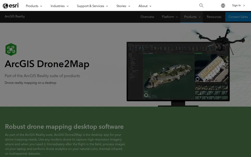
Esri ArcGIS Drone2Map is designed for desktop 2D and 3D photogrammetry in GIS. ArcGIS Drone2Map is a desktop application from Esri aimed at GIS drone mapping. Since it is a desktop app, processing relies on local hardware instead of a browser.
The most solid experience comes from staying within the Esri ecosystem. Teams wanting a familiar Esri environment for drone processing are the clearest fit. Esri ArcGIS Drone2Map does not show a starting price in this comparison, so check the vendor site for current pricing. Trial and free access: Not stated.
Ask Skycatch, Trimble Business Center, PrecisionHawk and Esri ArcGIS Drone2Map for a written quote, since no starting price is shown.
Look at the free plan from Mapbox closely: its caps decide whether it is usable for real work.
Before choosing Skycatch, weigh its main limit: Mining-centric positioning.
Find out whether the entry plan of Esri ArcGIS Drone2Map covers your must-haves or only a trimmed-down version.
Ask whether Mapbox integrates with your current software, and whether that comes standard or as an add-on.
How we picked
Selection started from tools commonly considered for drone analytics software for startups, then narrowed to 5 that have clear pricing information or a clear quote process. Where a price is missing, the vendor does not list one publicly or ties it to a quote. Always confirm before budgeting. Tools are placed by general fit for drone analytics software for startups, with price clarity and free access as tie-breakers. A different team can reasonably rank them differently.
Every price and plan detail on this page comes from the vendors’ own websites. We did not run hands-on tests unless the text says so, and we do not publish star ratings or review scores. See how we score and our disclosure.
Keep your shortlist in one place
Paste prices, trial dates and notes from this guide into Ainotely, our AI note app. It files them into a topic and pulls out tasks like “cancel trial by Friday”. Free 7-day trial, no card needed.
Often, yes. Mapbox has a free plan. Use your own data and a real task during the test, and check what the free tier or trial limits before you rely on it. All 5 picks in this Drone analytics software for startups comparison show their pricing, free plan details and main limits on the cards above.
Do these tools publish their prices?
Not all of them. Skycatch, Trimble Business Center, PrecisionHawk and Esri ArcGIS Drone2Map publish no starting price, so expect a quote request for those. The rest, Mapbox included, show a starting price, though seats and billing terms still change the final cost.
Is Skycatch the right pick for everyone comparing drone analytics software for startups?
No single tool suits every team. Skycatch comes first because it fits Mining-focused spatial data and AI, while Trimble Business Center suits office processing of survey and drone data and Mapbox suits custom maps and location APIs in apps. Match the tool to your own size, budget and workflow before deciding.
How are the tools for drone analytics software for startups ordered?
The order follows typical fit for drone analytics software for startups, with Skycatch first and Esri ArcGIS Drone2Map last, then price clarity and free access. It is editorial judgement, not a score, so another team could rank the tools differently.
Is photogrammetry software the same as drone analytics?
Photogrammetry tools like ArcGIS Drone2Map convert drone imagery into 2D and 3D outputs, which is frequently the foundation of analytics. Analytics systems then add interpretation, like earthworks measurement or mining planning support, on top of those outputs.