Best GPS Apps in 2026: 8 Apps Compared

- 1
 Google Mapseveryday driving, transit, and place searchVisit
- 2
 Wazelive traffic alerts and city drivingVisit
- 3
 Apple MapsiPhone users wanting system integrationVisit
- 4
 HERE WeGooffline navigation for travel and rural drivingVisit
- 5
 Sygic GPS Navigationpremium offline navigation with live trafficVisit
- Google Maps is the best all-round GPS app, with driving, transit, walking, cycling, and offline areas.
- Waze is best for live driving alerts and traffic avoidance in cities.
- Apple Maps is best for iPhone users who want deep system integration.
- HERE WeGo is best for offline navigation when signal is unreliable.
Quick comparison
| Product | Ideal for | Price from | Free version | |
|---|---|---|---|---|
| Google Maps | everyday driving, transit, and place search | Free | Yes | Visit |
| Waze | live traffic alerts and city driving | Free | Yes | Visit |
| Apple Maps | iPhone users wanting system integration | Free | Yes | Visit |
| HERE WeGo | offline navigation for travel and rural driving | Free | Yes | Visit |
| Sygic GPS Navigation | premium offline navigation with live traffic | See website | Yes | Visit |
 OsmAnd | privacy-minded offline maps and hiking | Free | Yes | Visit |
 Citymapper | public transit in supported cities | Free | Yes | Visit |
 TomTom GO Navigation | drivers wanting TomTom traffic and offline maps | See website | Yes | Visit |
The best GPS apps
GPS apps differ on traffic data, offline maps, transit, and privacy, and most of the best ones are free. The right pick depends on whether you drive, walk, take transit, hike, or need maps without a signal.
Google Maps
Ideal for: everyday driving, transit, and place search
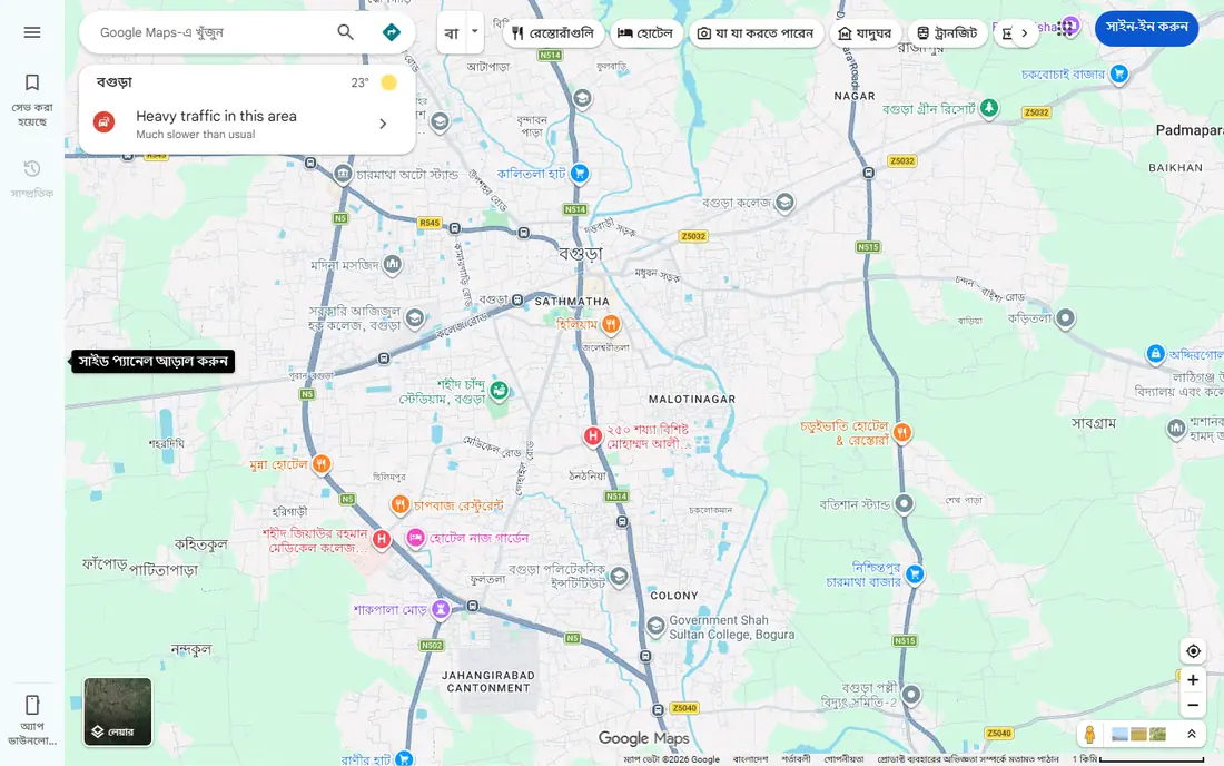
Google Maps works best for everyday driving, transit, and place search. Google Maps covers driving, walking, cycling, and transit with live traffic, place search, and downloadable offline areas. Pricing starts at Free, and a free plan is available. This is the option to look at first if that description matches your situation.
Location data feeds Google services, and offline walking, cycling, and transit directions are limited, so download areas before travel. That trade-off matters most if you were hoping for a single tool that covers every situation without compromise. Compared with the other options here, Google Maps stands out for everyday driving, transit, and place search, while asking you to accept that Privacy trade-offs. Weigh that honestly against your budget and your patience for setup before you commit.
- Multi-modal routing
- Offline areas
- Street View
- Live traffic
- Privacy trade-offs
- Offline walking and transit are limited
Waze
Ideal for: live traffic alerts and city driving
Waze works best for live traffic alerts and city driving. Waze uses community reports for hazards, police, and jams, rerouting drivers around trouble in real time. Pricing starts at Free, and a free plan is available. Put this one near the top of your shortlist when the fit sounds right.
It needs a data connection for reliable routing, shows ads, and is weak for walking, cycling, and transit. That trade-off matters most if you were hoping for a single tool that covers every situation without compromise. Compared with the other options here, Waze stands out for live traffic alerts and city driving, while asking you to accept that Needs data for full routing. Weigh that honestly against your budget and your patience for setup before you commit.
- Community hazard alerts
- Live rerouting
- Fuel and toll help
- Needs data for full routing
- Ads
- Weak for walking and transit
Apple Maps
Ideal for: iPhone users wanting system integration
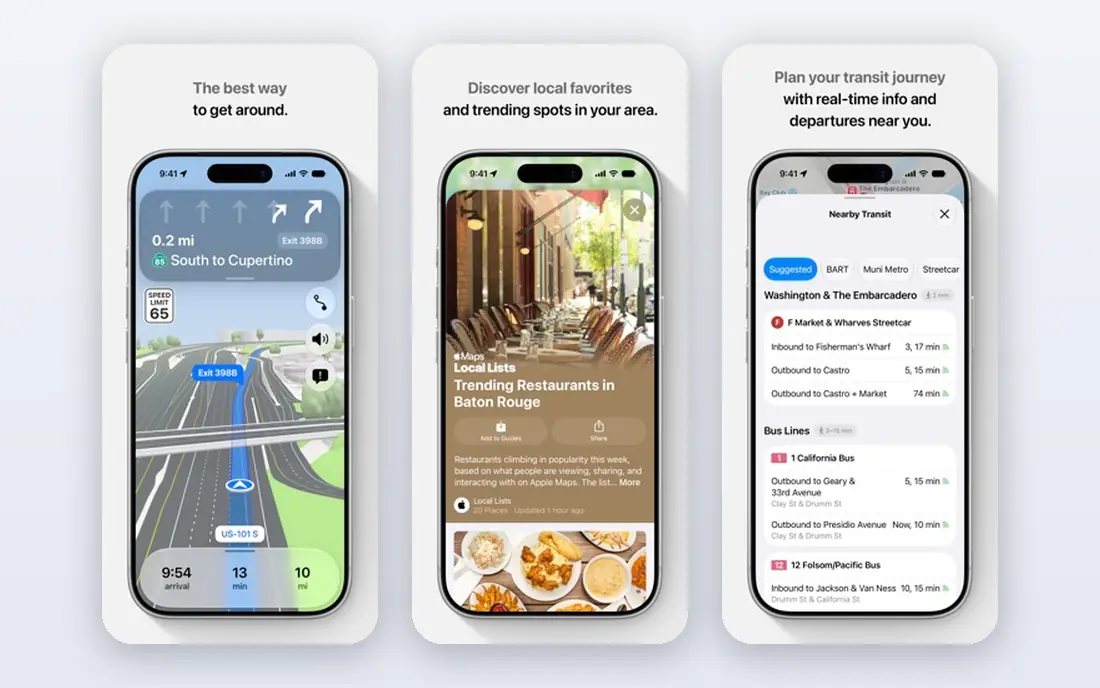
Apple Maps works best for iPhone users wanting system integration. Apple Maps integrates deeply with iPhone, CarPlay, and Apple Watch, with offline maps in selected areas. Pricing starts at Free, and a free plan is available. This choice makes the most sense for readers who match the description above.
It is Apple only, so Android users need another app, and transit coverage varies by city. That trade-off matters most if you were hoping for a single tool that covers every situation without compromise. Compared with the other options here, Apple Maps stands out for iPhone users wanting system integration, while asking you to accept that Apple only. Weigh that honestly against your budget and your patience for setup before you commit.
- Deep iOS integration
- Offline maps in selected areas
- Clean design
- Apple only
- Transit coverage varies by city
HERE WeGo
Ideal for: offline navigation for travel and rural driving
HERE WeGo works best for offline navigation for travel and rural driving. HERE WeGo downloads whole regions for offline voice navigation, which suits rural driving and travel without signal. Pricing starts at Free, and a free plan is available. Consider this option closely if you want the balance it offers.
Live traffic alerts are weaker than Waze, and place data is thinner than Google Maps. That trade-off matters most if you were hoping for a single tool that covers every situation without compromise. Compared with the other options here, HERE WeGo stands out for offline navigation for travel and rural driving, while asking you to accept that Live alerts are weaker. Weigh that honestly against your budget and your patience for setup before you commit.
- Strong offline maps
- Voice guidance offline
- Public transit
- Live alerts are weaker
- Place data thinner than Google
Sygic GPS Navigation
Ideal for: premium offline navigation with live traffic
Sygic GPS Navigation works best for premium offline navigation with live traffic. Sygic pairs offline maps with paid live traffic, speed camera alerts, and CarPlay support for drivers who travel widely. Pricing starts at See website, and a free plan is available. This is a strong candidate when your priorities line up with its strengths.
Paid features add cost, and premium tiers vary by region, so check the store listing for your country. That trade-off matters most if you were hoping for a single tool that covers every situation without compromise. Compared with the other options here, Sygic GPS Navigation stands out for premium offline navigation with live traffic, while asking you to accept that Paid features add cost. Weigh that honestly against your budget and your patience for setup before you commit.
- Offline maps plus paid live traffic
- Speed camera alerts
- CarPlay
- Paid features add cost
- Premium tiers vary by region
OsmAnd
Ideal for: privacy-minded offline maps and hiking
OsmAnd works best for privacy-minded offline maps and hiking. OsmAnd uses OpenStreetMap data offline with hiking and cycling routes, and it avoids tracking. Pricing starts at Free, and a free plan is available. Keep this one in mind if the trade-offs below are acceptable to you.
The interface is complex for casual drivers, and live traffic is limited compared with Google Maps or Waze. That trade-off matters most if you were hoping for a single tool that covers every situation without compromise. Compared with the other options here, OsmAnd stands out for privacy-minded offline maps and hiking, while asking you to accept that Interface is complex. Weigh that honestly against your budget and your patience for setup before you commit.
- Offline OpenStreetMap data
- Hiking and cycling routes
- No tracking
- Interface is complex
- Live traffic is limited
Citymapper
Ideal for: public transit in supported cities
Citymapper works best for public transit in supported cities. Citymapper excels at public transit in supported cities, with live departures, disruptions, and multi-modal trips. Pricing starts at Free, and a free plan is available. This option earns its place for the specific audience named above.
Coverage is limited to supported cities, and live departures need a connection, so keep a backup app for other cities. That trade-off matters most if you were hoping for a single tool that covers every situation without compromise. Compared with the other options here, Citymapper stands out for public transit in supported cities, while asking you to accept that Coverage limited to supported cities. Weigh that honestly against your budget and your patience for setup before you commit.
- Excellent transit routing
- Live departures
- Multi-modal trips
- Coverage limited to supported cities
- Live data needs connection
TomTom GO Navigation
Ideal for: drivers wanting TomTom traffic and offline maps
TomTom GO Navigation works best for drivers wanting TomTom traffic and offline maps. TomTom GO Navigation offers TomTom traffic, offline maps, and speed camera alerts for drivers who trust the brand. Pricing starts at See website, and a free plan is available. Round out your shortlist with this option if its approach appeals to you.
Full features need a paid subscription, and store pricing varies by region, so check before subscribing. That trade-off matters most if you were hoping for a single tool that covers every situation without compromise. Compared with the other options here, TomTom GO Navigation stands out for drivers wanting TomTom traffic and offline maps, while asking you to accept that Paid subscription for full features. Weigh that honestly against your budget and your patience for setup before you commit.
- TomTom traffic
- Offline maps
- Speed camera alerts
- Paid subscription for full features
- Store listing varies
How we picked these
We compared official feature pages, pricing pages, app store listings, privacy policies, and public reviews for each option, and we kept only products that exist and work today and that truly fit the topic. We gave weight to clear pricing, a usable free or trial option where one is offered, and honest limits stated on the vendor site. We did not claim hands-on testing we did not do, and where a price could not be verified on the vendor site we wrote See website instead of guessing. Our pick for most people is usually the option that covers the core job well at a fair price, not the one with the longest feature list. That said, the right answer depends on your situation, so use the comparison table to narrow the list to two or three options, then check the current pricing page before you pay.
How to choose a GPS app
Start with travel mode. Drivers suit Google Maps or Waze, transit riders suit Citymapper, hikers suit OsmAnd, and offline travelers suit HERE WeGo.
Next, check offline needs. Download maps over Wi-Fi before trips without signal, and test voice guidance offline, since some apps limit offline modes.
Finally, consider privacy. Free apps funded by data collection differ from privacy-focused options like OsmAnd, so read the privacy policy for location handling.
Frequently asked questions
What is the best GPS app?
Google Maps is best all-round, Waze is best for live traffic alerts, Apple Maps is best for iPhone users, and HERE WeGo is best offline. The right pick depends on travel mode.
Is Google Maps or Waze better for driving?
Google Maps suits most drivers with places, transit, and offline areas, while Waze is stronger for dodging traffic with community alerts. Both are free and owned by Google.
Which GPS app works best offline?
HERE WeGo and OsmAnd are strongest offline, with whole-region downloads and voice guidance. Google Maps supports offline driving areas, while Waze needs data for full routing.
Is there a free GPS app with no ads?
Google Maps and Apple Maps are free without typical app ads, while Waze shows ads. OsmAnd is free and privacy-focused, with paid options for extra features.
Can GPS apps track family members?
Some apps and phone features offer location sharing for family, including Google Maps location sharing and Apple Find My. Dedicated family tracking apps add geofencing and alerts, with privacy trade-offs to review.