Best Hunting Apps in 2026: 7 Apps Compared

- onX Hunt is the most complete hunting map app, with land ownership and offline maps.
- HuntStand offers strong mapping and weather tools at a lower price.
- Basemap suits hunters who want detailed maps and 3D views for scouting.
- GoHUNT helps western big-game hunters with draw odds and unit research.
Quick comparison
| Product | Ideal for | Price from | Free version | |
|---|---|---|---|---|
 onX Hunt | Most complete hunting maps | See website | Free trial | Visit |
 HuntStand | Strong maps at a lower price | Free | Yes | Visit |
 Basemap | Detailed 3D scouting maps | See website | Free trial | Visit |
 GoHUNT | Western big-game research | See website | Free trial | Visit |
 HuntWise | Weather and game predictions | Free | Yes | Visit |
 Spartan Forge | AI-assisted scouting insight | See website | Free trial | Visit |
 Powderhook | Free maps and community | Free | Yes | Visit |
The best hunting apps
Hunting apps help with the practical side of a hunt: finding public land boundaries, marking stands and trails, checking weather and wind, and navigating offline where signal fails. The apps below differ in map detail, land data and price, and the best one depends on your state, species and how far off-grid you go. Always check local hunting laws and seasons, since an app does not replace regulations.
onX Hunt
Ideal for: Most complete hunting maps
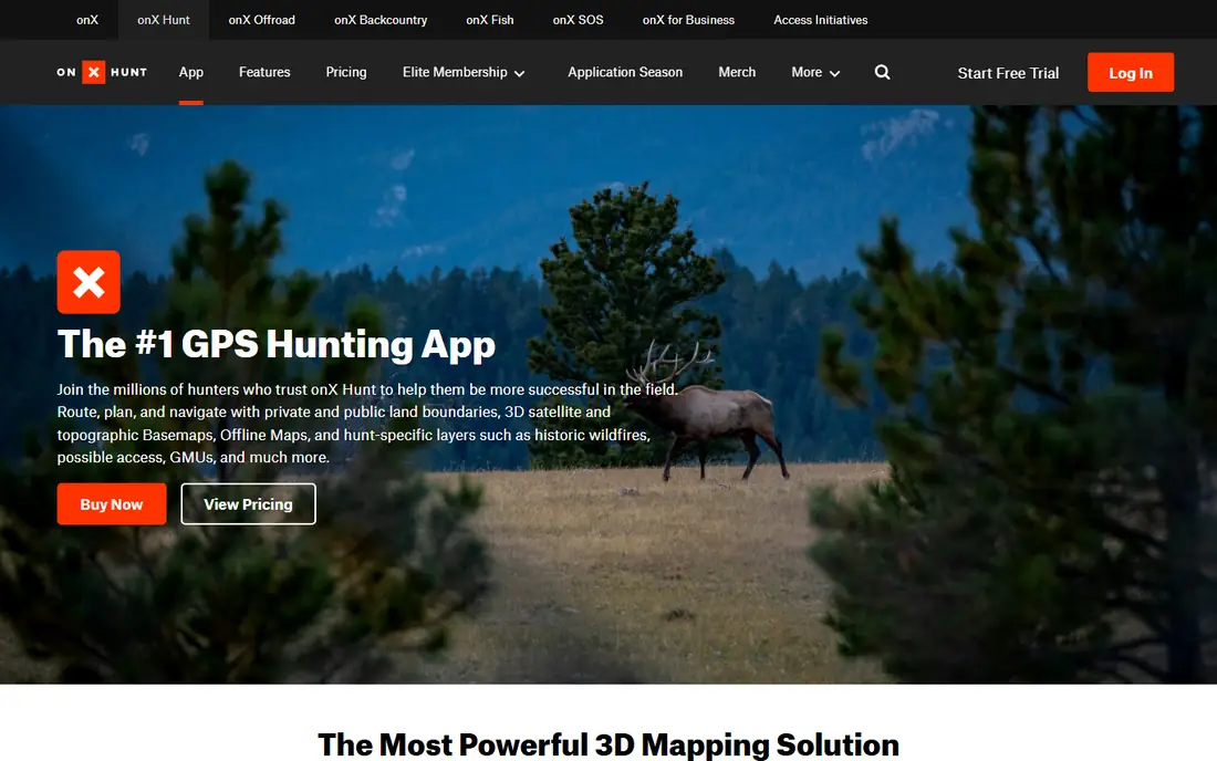
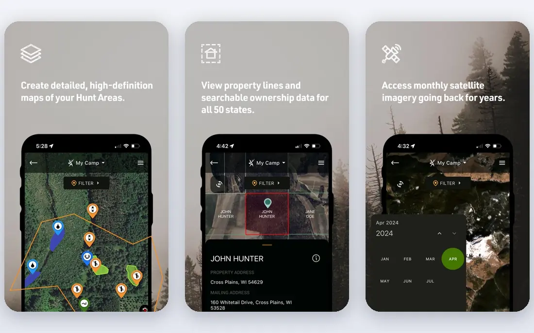
onX Hunt is the standard hunting map app, with public and private land boundaries, ownership details, offline maps, tracking and waypoints. Its map layers cover roads, trails, water and land designations, and its offline downloads work where signal fails. Hunters in most US states rely on it for access questions.
The subscription costs money, and full features need the higher Elite tier. Its depth can also overwhelm beginners. For serious hunters who need accurate land data, onX Hunt is the best investment here.
For readers focused on most complete hunting maps, onX Hunt is worth a trial before deciding, since the free tier or trial shows its real feel fast. Check the current plan details on the vendor site, since prices and limits change, and confirm that the version you need works on your devices.
- Land ownership and boundaries
- Offline maps
- Tracking and waypoints
- Subscription cost
- Full features need the Elite tier
HuntStand
Ideal for: Strong maps at a lower price
HuntStand offers mapping, land data, weather and wind tools with a free tier for basic use. Its satellite and topographic maps help scouting, its weather tools support stand decisions, and its social features let hunting groups share maps and sightings. The price undercuts onX for many hunters.
Land data depth trails onX Hunt in some states, and premium features need a paid plan. Its interface also takes learning. For hunters who want strong maps at a lower price, HuntStand is a smart alternative.
We would shortlist HuntStand for strong maps at a lower price, and compare it directly with the two options nearest it in price before paying. Check the current plan details on the vendor site, since prices and limits change, and confirm that the version you need works on your devices.
- Mapping and land data
- Weather and wind tools
- Free tier
- Land data depth trails onX in some states
- Premium features are paid
Basemap
Ideal for: Detailed 3D scouting maps
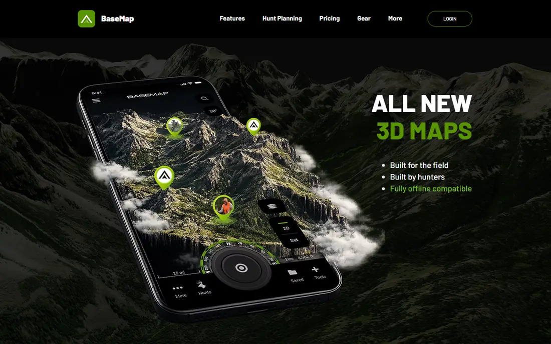
Basemap focuses on detailed hunting maps with 3D views that help scouts read terrain, ridges and funnels before a hunt. Its land ownership layers, offline maps and waypoint tools cover the core hunting needs, and its 3D terrain stands out for mountain and hill country.
The subscription costs money, and coverage and detail vary by state. Its community and extra features are smaller than onX. For hunters who scout terrain visually, Basemap 3D views are a real advantage.
If detailed 3D scouting maps is your main need, Basemap deserves a place on a shortlist, provided you test the catch described above first. Check the current plan details on the vendor site, since prices and limits change, and confirm that the version you need works on your devices.
- Detailed maps with 3D views
- Land ownership
- Offline use
- Subscription cost
- Coverage varies by state
GoHUNT
Ideal for: Western big-game research
GoHUNT serves western big-game hunters with draw odds, unit research, maps and application reminders for tags. Its research tools help hunters choose units and understand draw chances, which is the hardest part of western hunting. Its maps and gear shop support the full trip.
Its western focus limits value for eastern hunters, and the subscription costs money. Casual hunters may not need its research depth. For western big-game hunters, GoHUNT research is unmatched.
Our view is that GoHUNT earns its place here for western big-game research, even with the limits noted above. Check the current plan details on the vendor site, since prices and limits change, and confirm that the version you need works on your devices.
- Draw odds and unit research
- Maps
- Gear shop
- Western focus limits eastern hunters
- Subscription cost
HuntWise
Ideal for: Weather and game predictions
HuntWise combines maps with weather, wind and game activity predictions that help hunters pick stand times and locations. Its free tier covers basic maps and forecasts, while paid tiers add detailed predictions and land data. Whitetail hunters use its rut and movement forecasts widely.
Predictions are guides, not guarantees, and local knowledge still matters more than any forecast. Premium features need a paid plan. For hunters who plan around weather and movement patterns, HuntWise is a useful companion.
For readers focused on weather and game predictions, HuntWise is worth a trial before deciding, since the free tier or trial shows its real feel fast. Check the current plan details on the vendor site, since prices and limits change, and confirm that the version you need works on your devices.
- Weather, wind and game activity predictions
- Maps
- Free tier
- Predictions are guides, not guarantees
- Premium features are paid
Spartan Forge
Ideal for: AI-assisted scouting insight
Spartan Forge uses AI-assisted analysis of terrain, cover and deer patterns to suggest scouting areas, with maps and journal tools for recording observations. Its approach suits tech-friendly hunters who want data-driven scouting help beyond standard maps.
It is a newer platform, coverage and accuracy vary by region, and the subscription costs money. Traditional scouts may prefer proven map apps. For hunters curious about AI-assisted scouting, Spartan Forge is an interesting option.
We would shortlist Spartan Forge for aI-assisted scouting insight, and compare it directly with the two options nearest it in price before paying. Check the current plan details on the vendor site, since prices and limits change, and confirm that the version you need works on your devices.
- AI terrain and deer pattern insight
- Maps
- Journal tools
- Newer platform
- Subscription cost
- Coverage varies
Powderhook
Ideal for: Free maps and community
Powderhook offers free maps, land data and community features for hunters and anglers, with trip planning tools and basic offline use. Its free price makes it accessible for beginners, and its community shares access tips and locations. It is a good starting app before committing to a paid map service.
Feature depth trails paid rivals such as onX and HuntStand, and its smaller team means slower updates. Serious hunters will likely upgrade. As a free introduction to hunting maps, Powderhook is worth trying.
If free maps and community is your main need, Powderhook deserves a place on a shortlist, provided you test the catch described above first. Check the current plan details on the vendor site, since prices and limits change, and confirm that the version you need works on your devices.
- Free maps and land data
- Community and trip planning
- Offline basics
- Feature depth trails paid rivals
- Smaller team and updates
How we picked these
We compared official feature pages, pricing pages, app store listings, privacy policies and public reviews for each option below. We checked that each product is still available and that its stated plans match what the vendor publishes. We did not run hands-on tests, so our picks rest on documented features, pricing and the fit for the reader described in each section, not on lab results. Where a price could not be confirmed on the vendor site at the time of writing, we wrote See website rather than guessing. We also looked at how each option handles the everyday details that decide whether a tool gets used: setup time, device support, what happens when you cancel or downgrade, and whether help is available when something breaks. A product that looks strong on a feature list but is hard to set up, hard to leave, or poorly supported will cost more in time than it saves, so we weighed those practical points alongside price and features. Where reviewers or users reported a recurring problem, we noted it in the honest catch for that product, rather than leaving it out because the vendor page did not mention it.
How to choose a hunting app for your area
Start with land data for your state, since ownership boundaries and public access rules vary and not every app covers every state equally. Check offline maps, because signal fails in exactly the places hunters go, and download maps before you leave. Look at weather and wind tools for your hunt type, since wind direction decides stand placement. Finally, test the app on a scouting trip, not on opening day, so you learn its layers and battery use before it matters.
A final check before you commit
Run a short trial on a real task before you pay for a year or move a whole team. Use the free plan or trial to complete one full job, from setup to export or delivery, and note where you got stuck. Check the cancellation path too: can you leave and keep your data, or does leaving mean starting over? Read the pricing page for renewal rates, not just the first-year offer, and confirm what support you get on the plan you will actually buy. Finally, ask one current user about the worst part of the product, since that answer tells you more than any feature list. If the trial feels good on a real task and the exit path is clear, the choice is much safer.
Frequently asked questions
What is the best hunting app?
onX Hunt is the most complete hunting map app, with land ownership, offline maps and tracking. HuntStand is a strong lower-priced alternative, while Basemap suits hunters who want detailed 3D scouting maps.
Do hunting apps work offline?
Yes, the leading apps let you download maps for offline use, which is essential where cell signal fails. Download your hunting area maps on Wi-Fi before the trip and test them in airplane mode.
What is the difference between onX Hunt and HuntStand?
onX Hunt leads on land ownership data and map detail, with a higher subscription price. HuntStand offers similar mapping and weather tools at a lower price, with a free tier for basic use.
Can hunting apps show private land boundaries?
Yes, onX Hunt, HuntStand and Basemap show public and private land boundaries and ownership details in many states. Always respect posted land and local trespass laws, since app data can lag behind real ownership changes.
Are hunting apps legal to use?
Yes, for maps, navigation and weather. Rules on electronic devices, baiting, calls and real-time game tracking vary by state and species, so check your state regulations before relying on any feature.