Best MapPoint Alternatives in 2026: 7 Tools Compared

- Maptitude is our pick for most former MapPoint users, since it covers desktop mapping, territories, and demographics in one Windows app.
- Route4Me and Badger Maps suit field teams that care more about daily routes than deep map analysis.
- QGIS is the best free option for skilled map users, while ArcGIS suits organizations that need enterprise mapping and sharing.
- MapQuest and Mapline cover lighter needs, from simple directions to quick sales maps from a spreadsheet.
- Before you switch, check file compatibility, since old MapPoint files and territory shapes do not always move cleanly.
Quick comparison
| Product | Ideal for | Price from | Free version | |
|---|---|---|---|---|
 Maptitude | Desktop mapping and territories | See website | See website | Visit |
 Route4Me | Multi-stop route planning | See website | Free trial | Visit |
 Badger Maps | Field sales routes | See website | Free trial | Visit |
 MapQuest | Simple maps and directions | Free | Yes | Visit |
 ArcGIS | Enterprise mapping and analysis | See website | Free trial | Visit |
 QGIS | Free open-source mapping | Free | Yes | Visit |
 Mapline | Quick maps from spreadsheets | See website | Free trial | Visit |
The best MapPoint alternatives
Microsoft MapPoint is long gone, but its core jobs live on: plot customer data on a map, draw territories, plan routes, and print or share the result. We compared official feature pages, pricing pages, and public reviews, focusing on desktop mapping, territory tools, routing, data compatibility, and whether a free tier exists.
Maptitude
Ideal for: Desktop mapping and territories
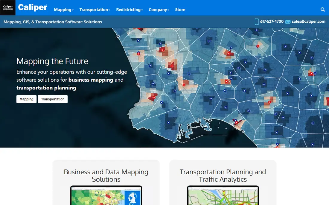
Maptitude, from Caliper, is the most direct MapPoint successor in spirit. It is a desktop mapping and GIS tool that lets you map addresses, color-code postal areas, build territories, run radius and drive-time analysis, and present results in maps and reports. It also imports common formats such as shapefiles, MapInfo files, and older MapPoint data types, which eases the move for long-time users.
The trade-offs are platform and price. Maptitude is a Windows desktop product at heart, and its licenses cost far more than a casual mapping app. For businesses that map customers, territories, and demographics every week, that depth is worth it. For someone who only needs occasional directions, a free web map will do the job for far less.
- Purpose-built MapPoint-style desktop mapping
- Territory building and demographic data
- Imports common GIS formats
- Windows-focused desktop product
- Pricing is high for casual users
Route4Me
Ideal for: Multi-stop route planning

Route4Me focuses on the routing half of MapPoint and does it well. You can import a list of stops, optimize the order, balance routes across drivers, and send plans to mobile apps with tracking and proof of delivery. Dispatchers get a live view of progress, and drivers get turn-by-turn guidance without paper printouts.
What Route4Me does not do is deep map analysis. It will not replace territory design or demographic mapping, and its pricing scales with team size and volume. Delivery teams, field service crews, and sales reps with long daily stop lists will get the most value. Pair it with a mapping tool if you also need territory work.
- Strong multi-stop optimization
- Mobile apps for drivers
- Tracking and proof of delivery
- Less of a general mapping analysis tool
- Costs scale with drivers and stops
Badger Maps
Ideal for: Field sales routes

Badger Maps is built for field sales teams that live on the road. It combines mapping with CRM data, route optimization, scheduling, territory views, and a mobile app that offers turn-by-turn directions and live traffic updates. Reps can filter customers, draw around an area, and build a day of visits in minutes, then check in at each stop to build a visit history.
The sales focus is also its limit. Badger Maps is not a general GIS analysis tool, and its subscription can feel steep for a solo rep. For sales teams that already track customers in a CRM and want routes that reflect real priorities, it is a practical MapPoint replacement for the daily driving job.
- Built for field sales
- Route optimization with CRM data
- Mobile app with live traffic
- Sales focus limits general mapping use
- Subscription cost adds up for solo reps
MapQuest
Ideal for: Simple maps and directions
MapQuest is the simplest option here, and sometimes simple is enough. It offers free maps, directions, and multi-stop routing in a browser, with no install and no learning curve. For a small business that only needs to plan a trip, check a route, or print directions, MapQuest covers the job at zero cost.
It is not a MapPoint replacement for analysis. There are no territory builders, no demographic layers, and no serious customer data mapping. Use MapQuest for quick routing and directions, and pair it with Maptitude or QGIS when you need to analyze where customers cluster or how territories should change.
- Free and familiar
- Simple directions and multi-stop routes
- No install needed
- No territory or demographic analysis
- Limited business data tools
ArcGIS
Ideal for: Enterprise mapping and analysis
ArcGIS, from Esri, is the enterprise standard for mapping and geographic analysis. ArcGIS Online and its desktop apps cover data creation, spatial analysis, territory design, routing, and sharing through web maps and dashboards. Organizations in government, utilities, and large business rely on it for work that smaller tools cannot handle.
Small teams should weigh cost and complexity. ArcGIS is priced and built for organizations, and new users face a steep learning curve. If your mapping needs are occasional or simple, QGIS or Maptitude will serve you faster and cheaper. If you need enterprise sharing, governance, and advanced analysis, ArcGIS is the safe long-term pick.
- Deep analysis and data tools
- Strong sharing and web maps
- Huge data and extension library
- Expensive and complex for small teams
- Learning curve is steep
QGIS
Ideal for: Free open-source mapping
QGIS is a free, open-source geographic information system that covers much of what ArcGIS does, including mapping, analysis, routing plugins, and support for a wide range of data formats. A large plugin library extends it further, and an active community produces guides and answers. For skilled users and tight budgets, it is remarkable value.
The catch is effort. QGIS expects you to learn GIS concepts, and there is no single vendor support line unless you hire help. Beginners should budget learning time and start with a small project, such as mapping customers from a spreadsheet. For teams with GIS skill, QGIS can replace MapPoint analysis work at zero license cost.
- Free and open source
- Deep GIS analysis
- Large plugin library and format support
- Steep learning curve
- No vendor support unless you pay a third party
Mapline
Ideal for: Quick maps from spreadsheets
Mapline is built for business users who want a map from a spreadsheet without learning GIS. Upload your data, and Mapline plots it, lets you build territories, run radius maps, and share the result with your team. That speed makes it a good fit for sales planning, site selection, and customer mapping when you need answers this week, not after a training course.
Depth is the limit. Mapline does not match QGIS or ArcGIS for advanced spatial analysis, and heavy or unusual data may need a desktop tool. For sales and marketing teams that map from spreadsheets every month, though, Mapline hits a sweet spot between simple web maps and full GIS software.
- Fast spreadsheet-to-map workflow
- Territory and radius tools
- Easy sharing
- Less deep than desktop GIS tools
- Advanced analysis needs a fuller GIS product
How we picked these
We compared official feature pages, pricing pages, and public reviews, and we checked that the homepages listed here belong to the products named. We favored tools that cover at least one core MapPoint job: desktop mapping, territory design, customer data mapping, or multi-stop routing. We left out pure navigation apps with no business mapping, and we did not include MapPoint itself, since it is discontinued.
We also weighed how each vendor treats new users, including trial length, onboarding help, and the quality of its public documentation. A tool with clear guides and responsive support earns trust faster than a tool with a thin help center, even when feature lists look similar. We gave extra weight to vendors that publish pricing openly and explain limits plainly, since hidden costs and surprise caps cause most buyer regret. Where pricing was only available on request, we said so rather than guessing, and we treated a missing free tier as a real drawback for small teams testing on a budget.
What to check before you switch
Start with your files. List the formats you rely on, including old MapPoint files, spreadsheets, shapefiles, and territory definitions, then test an import into each finalist before buying. A tool that cannot read your territory shapes will cost you weeks of rebuilding, no matter how good its routing looks.
Next, separate routing from analysis. Route planners such as Route4Me and Badger Maps excel at daily driving, while Maptitude, ArcGIS, and QGIS excel at understanding where customers are and how territories should change. Many former MapPoint users need both jobs, so budget for two tools if one cannot cover everything.
Finally, test with real data and real users. Build one territory map and one week of routes, then hand them to the people who will use them daily. Check print quality, mobile use in the field, and how easily maps can be shared with colleagues. The best tool is the one your team actually uses after the trial ends.
Plan your exit before you enter. Check how your data exports, which formats are supported, and whether you can leave without losing history, templates, or customer records. A tool with clean exports gives you freedom to change later if pricing, features, or support disappoint you, while a tool with weak exports locks you in quietly. Ask the vendor directly about export limits and migration help, and test an export with a sample of your own data during the trial. That single test often reveals more about a vendor than any sales call, and it protects you if your needs change next year.
Frequently asked questions
What is the closest alternative to MapPoint?
Maptitude is the closest desktop replacement, since it covers mapping, territories, demographics, and common GIS formats in a Windows app. QGIS is the closest free option for skilled users. Field teams that mainly need routes should look at Route4Me or Badger Maps instead.
Can I import my old MapPoint files?
Some tools, including Maptitude, support common GIS formats and older MapPoint data types, but results vary by file age and content. Export your data to a spreadsheet or shapefile where possible, and test an import before buying. Keep a copy of your original files until the new setup is proven.
Is there a free MapPoint alternative?
Yes. QGIS is free and open source, and MapQuest is free for simple maps and directions. Both cover real needs, though QGIS needs learning time and MapQuest lacks analysis tools. Mapline and others offer free trials if you want to test a paid tool first.
What is the best MapPoint alternative for route planning?
Route4Me is our pick for multi-stop route planning, with optimization, driver apps, and tracking. Badger Maps suits field sales routes tied to CRM data. MapQuest works for simple multi-stop trips at no cost.
Do I need GIS software to replace MapPoint?
Not always. If you only planned routes and printed directions, a route planner or web map may be enough. If you mapped customers, built territories, or analyzed demographics, you need a mapping tool such as Maptitude, Mapline, or QGIS.
How often should I review my choice?
Review your main tools at least once a year, and sooner if pricing, team size, or needs change sharply. A quick review covers cost per user, feature use, support quality, and whether the team still likes the tool day to day. If a cheaper or better-fitting option has appeared, run a small pilot before switching, since migration costs can outweigh modest savings. Regular reviews keep you from paying for seats nobody uses or sticking with a tool that no longer fits how your team actually works.