Esri ArcGIS Field Maps leads the list, best for mobile field data collection and mapping. Alternatives: Autodesk Civil 3D for surfaces and land development design, and CHCNAV LandStar for Field data collection with GNSS. All 5 tools are compared below on price, free plan and limits.
Choosing land survey software usually comes down to price, fit and limits. This Ainotely guide sets 5 tools side by side on those three points, with the facts kept short and checkable.
Key takeaways
Esri ArcGIS Field Maps sits first on this list: mobile field data collection and mapping.
No starting price is shown for any of the 5 tools, Esri ArcGIS Field Maps and Virtual Surveyor included, so plan time for sales calls.
Esri ArcGIS Field Maps, Virtual Surveyor and the 3 others all need a premium plan or a trial, since no free plan is listed.
Check the limits for Autodesk Civil 3D before you commit: steep ramp-up time for new users.
Best for: Mobile field data collection and mapping
Think of Esri ArcGIS Field Maps for mobile field data collection and mapping. Field Maps is a general mapping and collection tool, so precise survey workflows may need extra equipment and configuration. It is most valuable inside the ArcGIS ecosystem.
Limits to weigh: General-purpose.
In practice, Esri ArcGIS Field Maps is a field data collection app that simplifies mobile data collection and field management. In daily use, if you need dedicated survey drafting or design, pair it with a specialized tool. Esri ArcGIS Field Maps shows no starting price here, so confirm the cost on the vendor site. Free options: Not stated.
For surfaces and land development design, Autodesk Civil 3D is a natural candidate. On top of that, choose a dedicated field app if your primary need is capturing data on site.
Honest limits: Steep ramp-up time for new users.
Beyond that, Civil 3D is design-focused, so it is not the natural choice for in-field measurement or stakeout. New users face a ramp-up time before surface and corridor work feels efficient. This comparison lists no price for Autodesk Civil 3D; ask the vendor. Free options: Not stated.
CHCNAV LandStar is a good fit for Field data collection with GNSS. Choose a design or mapping tool if your primary need is processing instead of capture.
Where it falls short: Concentrated on field tasks, not office design.
Pricing for CHCNAV LandStar is not stated here, so ask the vendor for current figures. Free plan details: Not stated.
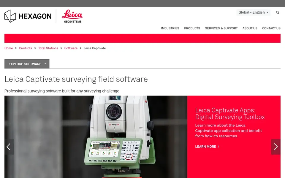
Pick Leica Captivate if this describes you: Field survey and stakeout workflows. Leica Captivate is field software for surveyors, delivering advanced 2D and 3D data visualization along with measurement and stakeout workflows.
Teams that want a single environment for both field capture and office drafting should keep reading. Beyond that, pick something else if your priority is desktop design instead of in-field measurement. Check the vendor site for Leica Captivate pricing; none is listed in this comparison. Trial and free access: Not stated.
Virtual Surveyor targets Drone-based topographic surveying. Virtual Surveyor is drone surveying software used for topographic surveying, mining and quarrying, construction earthworks and stockpile inventory. It helps build light CAD models from drone data, which fits teams that map terrain and track volumes from aerial capture.
Where it is weaker: Relies on drone-captured data.
It is a solid fit when drone imagery is already part of your workflow. From a buyer's view, the software depends on drone-captured data, so results rely on flight quality and processing inputs. It does not replace field capture instruments or full design suites. Virtual Surveyor does not show a starting price in this comparison, so check the vendor site for current pricing. On free options: Free trial.
Request quotes from Esri ArcGIS Field Maps, Virtual Surveyor and the others; the list shows no fixed prices.
Take the trial from Virtual Surveyor and push a live task through it before you pay.
Before choosing Esri ArcGIS Field Maps, weigh its main limit: general-purpose, not survey-grade by default.
Check whether the features you need in Virtual Surveyor sit on the entry plan or only on higher tiers.
Price Esri ArcGIS Field Maps for your actual team size; headline prices rarely include add-ons or overage.
How we picked
The comparison looks at four things: starting price, free access, how well the feature set matches land survey software, and the main limit of each tool. Where a vendor does not publish a price, the entry says quote. Where a price depends on seats or billing term, the entry says so. The order reflects how well each tool fits the most common buying scenario for land survey software, then price clarity, then free plan access. It is a starting point, not a verdict.
Every price and plan detail on this page comes from the vendors’ own websites. We did not run hands-on tests unless the text says so, and we do not publish star ratings or review scores. See how we score and our disclosure.
Keep your shortlist in one place
Paste prices, trial dates and notes from this guide into Ainotely, our AI note app. It files them into a topic and pulls out tasks like “cancel trial by Friday”. Free 7-day trial, no card needed.
How are the tools for land survey software ordered?
The order follows typical fit for land survey software, with Esri ArcGIS Field Maps first and Virtual Surveyor last, then price clarity and free access. It is editorial judgement, not a score, so another team could rank the tools differently.
What is the best land survey software for field work?
Esri ArcGIS Field Maps is the pick this page puts first, mainly for mobile field data collection and mapping. If your situation differs, Autodesk Civil 3D suits surfaces and land development design, and CHCNAV LandStar suits Field data collection with GNSS. Compare price and limits before you decide.
Can I try these options before paying?
Often, yes. Virtual Surveyor offers a free trial. Use your own data and a real task during the test, and check what the free tier or trial limits before you rely on it.
Do these tools publish their prices?
No. None of the tools, from Esri ArcGIS Field Maps to Virtual Surveyor, shows a fixed starting price here, so budget time for quotes.
Does any tool for land survey software here have a free plan?
A permanent free plan is not offered by Esri ArcGIS Field Maps, Virtual Surveyor or the other tools here. Virtual Surveyor offer a trial. Plan a short evaluation period instead.